
Former FSW and Mighty Mussels hitting coach joins Twins staff
Former FSW and Mighty Mussels hitting coach Rayden Sierra enters his first as a hitting coach for the Minnesota Twins.
SHOWING RESULTS FOR:
Filter results by:
Please try another search or check out the latest stories below.

Former FSW and Mighty Mussels hitting coach Rayden Sierra enters his first as a hitting coach for the Minnesota Twins.

Florida Gov. Ron DeSantis supports the idea of eliminating property taxes, raising questions about the future funding of local communities. WINK News explored how this change could impact residents.
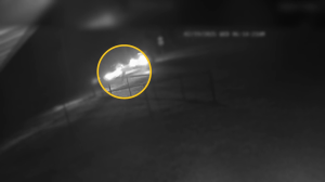
A police cruiser was involved in a crash, forcing a 16-year-old girl to jump out of the way while waiting for her school bus.

Here are some of Southwest Florida’s most wanted suspects for February 19, 2025.
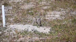
Cape Coral is taking steps to protect its burrowing owls.

The Gladiolus Food Pantry in Lee County is playing a crucial role in the fight against food insecurity.
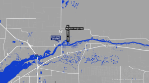
Lee County commissioners have approved amendments to the county’s comprehensive plan that could lead to redevelopment in a rural community.

The South Gulf Cove Homeowner Association will host a fundraising event to honor the late Charlotte County Sheriff’s Office deputy Sgt. Elio Diaz.

Waiting to find out if a suspicious lump is cancerous can be incredibly stressful. Anything that speeds up the process and leads to faster treatment, if needed, is a huge help.

Punta Gorda City Council on Feb. 19 voted unanimously to keep its 911 dispatch center under city control in a move that blocks the county from consolidating the city’s dispatch center with the Charlotte County Sheriff’s Office.

A Fort Myers man has been sentenced to two years and six months in prison for possessing marijuana with intent to distribute and a firearm as a person with felony convictions.

WINK News has confirmed that Immigration and Customs Enforcement is in Hendry County.

A Fort Myers woman has been sentenced to one year and one day in federal prison for acts of wire fraud involving her dead mother dating back to 2005.
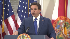
Florida Gov. Ron DeSantis will hold a news conference at the state capitol, 400 South Monroe Street, Tallahassee.

City of Fort Myers won’t be joining other local governments in removing fluoride from its drinking water, council members decided.

Former FSW and Mighty Mussels hitting coach Rayden Sierra enters his first as a hitting coach for the Minnesota Twins.

Florida Gov. Ron DeSantis supports the idea of eliminating property taxes, raising questions about the future funding of local communities. WINK News explored how this change could impact residents.

A police cruiser was involved in a crash, forcing a 16-year-old girl to jump out of the way while waiting for her school bus.

Here are some of Southwest Florida’s most wanted suspects for February 19, 2025.

Cape Coral is taking steps to protect its burrowing owls.

The Gladiolus Food Pantry in Lee County is playing a crucial role in the fight against food insecurity.

Lee County commissioners have approved amendments to the county’s comprehensive plan that could lead to redevelopment in a rural community.

The South Gulf Cove Homeowner Association will host a fundraising event to honor the late Charlotte County Sheriff’s Office deputy Sgt. Elio Diaz.

Waiting to find out if a suspicious lump is cancerous can be incredibly stressful. Anything that speeds up the process and leads to faster treatment, if needed, is a huge help.

Punta Gorda City Council on Feb. 19 voted unanimously to keep its 911 dispatch center under city control in a move that blocks the county from consolidating the city’s dispatch center with the Charlotte County Sheriff’s Office.

A Fort Myers man has been sentenced to two years and six months in prison for possessing marijuana with intent to distribute and a firearm as a person with felony convictions.

WINK News has confirmed that Immigration and Customs Enforcement is in Hendry County.

A Fort Myers woman has been sentenced to one year and one day in federal prison for acts of wire fraud involving her dead mother dating back to 2005.

Florida Gov. Ron DeSantis will hold a news conference at the state capitol, 400 South Monroe Street, Tallahassee.

City of Fort Myers won’t be joining other local governments in removing fluoride from its drinking water, council members decided.
Happy Thursday, Southwest Florida!

Highs will climb into the 90s. Cloud cover will increase into the afternoon ahead of increasing rain chances.

Isolated morning showers will become scattered by lunchtime. Expect rain and thunderstorms to continue into the evening before falling apart after dark.
![]()
A stalled front to our north will provide increased humidity and rain chances Friday.

Those chances become less likely throughout Labor Day weekend.

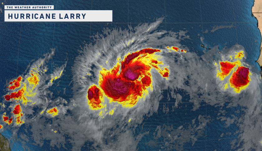
Three areas have caught our attention in the Atlantic.

There is a disturbance in the Caribbean with a low (20%) chance of formation over the next five days.

Hurricane Larry is now forecast to become a Category 4 hurricane over the Mid-Atlantic by Sunday.
![]()
This system likely poses no threat to Southwest Florida and is expected to take a sharp turn to the north (away from the U.S.) next week. This would be the third major hurricane of the 2021 hurricane season.

To the east of Larry is an additional disturbance with a low (30%) chance of formation over the next five days. This disturbance is over 3,000 miles away from Southwest Florida.