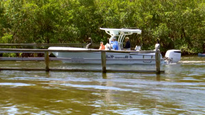
Boaters in Cape Coral prepare for removal of Chiquita Lock
The final days have arrived for the Chiquita Lock as crews prepare to remove it next to Cape Harbour on April 1. This decision follows years of debate over its removal.
SHOWING RESULTS FOR:
Filter results by:
Please try another search or check out the latest stories below.

The final days have arrived for the Chiquita Lock as crews prepare to remove it next to Cape Harbour on April 1. This decision follows years of debate over its removal.
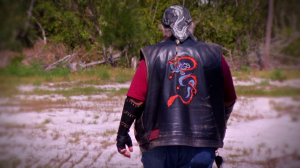
In Charlotte County, the aftermath of back-to-back hurricanes has left many residents struggling to rebuild their lives.

Florida has the highest percentage of people in the country with Parkinson’s disease.

A new bill in the Florida Senate could change how fast people can drive on the highway.
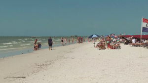
Spring break has arrived, drawing students from across the country to the shores of Southwest Florida.
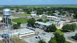
A new bill could bring significant changes to rural communities in Florida, focusing on improving education, health care, and overall development.

The collaboration between local police and ICE agents in Florida is stirring debate.

An Englewood home already devastated by Hurricane Milton was filled with smoke intentionally as part of a firefighter training exercise.

Florida Gov. Ron DeSantis held a roundtable discussion in Sarasota regarding illegal immigration in the United States where he mentioned Fort Myers.

FGCU women’s basketball team is off to Oklahoma ahead of its NCAA Tournament game against the Sooners.

With hurricane season approaching, an audience of almost 400 gathered at Naples United Church of Christ on March 18 for a forum on how Naples and other Collier County communities can better prepare for — and recover from — major storms.

Following Punta Gorda City Council’s unanimous approval of a memorandum of agreement between the city and the U.S. Immigration and Customs Enforcement, City Attorney David Levin said the agreement should have been limited and leaves the city vulnerable to lawsuits.

Starting Monday, drivers can expect intermittent lane closures on Pellam Boulevard from Morrisson Avenue to Cannolot Boulevard.

Eleven escaped cows have been impounded by the Hendry County Sheriff’s Office.

The Food and Drug Administration has recalled several frozen meal brand foods due to possible wood-like material found.

The final days have arrived for the Chiquita Lock as crews prepare to remove it next to Cape Harbour on April 1. This decision follows years of debate over its removal.

In Charlotte County, the aftermath of back-to-back hurricanes has left many residents struggling to rebuild their lives.

Florida has the highest percentage of people in the country with Parkinson’s disease.

A new bill in the Florida Senate could change how fast people can drive on the highway.

Spring break has arrived, drawing students from across the country to the shores of Southwest Florida.

A new bill could bring significant changes to rural communities in Florida, focusing on improving education, health care, and overall development.

The collaboration between local police and ICE agents in Florida is stirring debate.

An Englewood home already devastated by Hurricane Milton was filled with smoke intentionally as part of a firefighter training exercise.

Florida Gov. Ron DeSantis held a roundtable discussion in Sarasota regarding illegal immigration in the United States where he mentioned Fort Myers.

FGCU women’s basketball team is off to Oklahoma ahead of its NCAA Tournament game against the Sooners.

With hurricane season approaching, an audience of almost 400 gathered at Naples United Church of Christ on March 18 for a forum on how Naples and other Collier County communities can better prepare for — and recover from — major storms.

Following Punta Gorda City Council’s unanimous approval of a memorandum of agreement between the city and the U.S. Immigration and Customs Enforcement, City Attorney David Levin said the agreement should have been limited and leaves the city vulnerable to lawsuits.

Starting Monday, drivers can expect intermittent lane closures on Pellam Boulevard from Morrisson Avenue to Cannolot Boulevard.

Eleven escaped cows have been impounded by the Hendry County Sheriff’s Office.

The Food and Drug Administration has recalled several frozen meal brand foods due to possible wood-like material found.
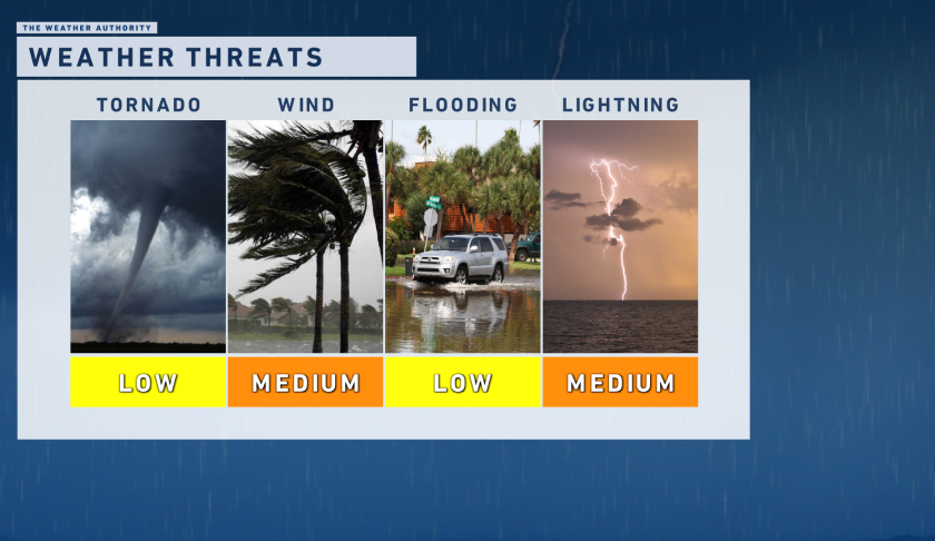
Scattered rain and storms will grow and expand across Southwest Florida as we approach the early-to-mid afternoon.

Pockets of heavy rain and rumbles of thunder will be a possibility from now through 8 p.m. as a front slowly moves south.

Some of these storms could become strong-to-severe. The Storm Prediction Center has us in a marginal risk (1/5) today.

Our primary impacts will be damaging wind gusts, small-to-medium sized hail, and frequent lightning. The threat of localized flooding is low today, and the tornado threat is low as well but not zero.

Multiple rounds of rain and storms are expected Tuesday and Wednesday as a front parks itself over Southwest Florida.

How much rain could we see? 1″ – 3″ is doable from Monday morning through Wednesday evening. This brings much needed relief to a local drought!
