
Florida restaurants may lose automatic tips for groups under 6
Lawmakers are currently debating a change that could impact how diners tip in Florida.
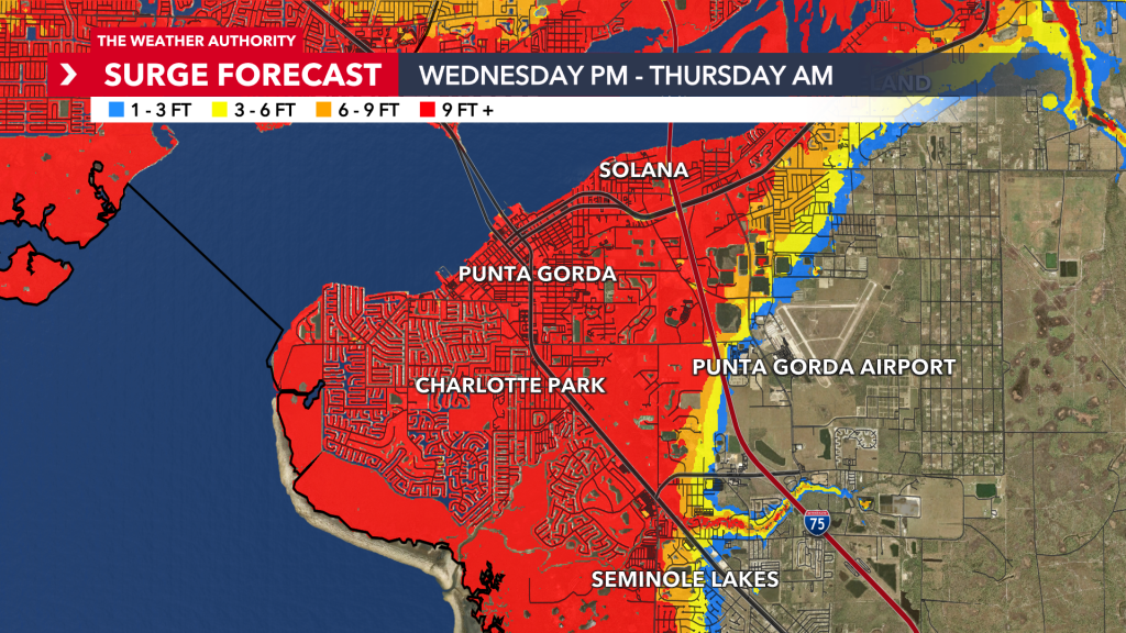
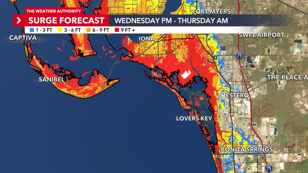
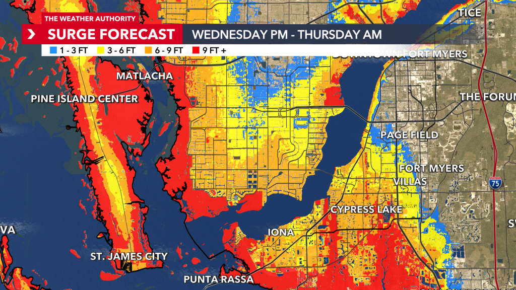
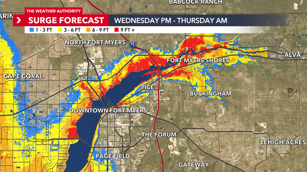
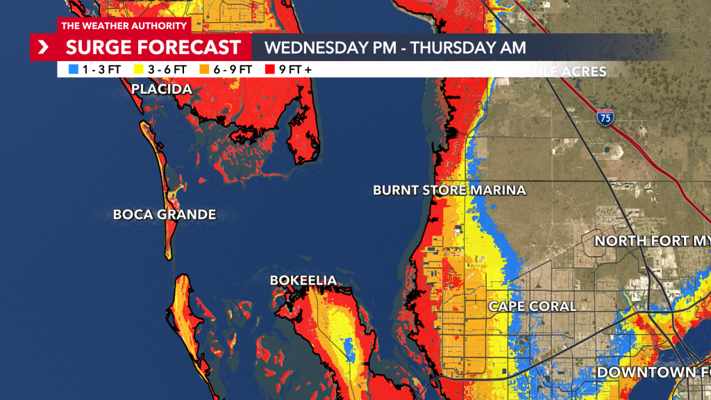
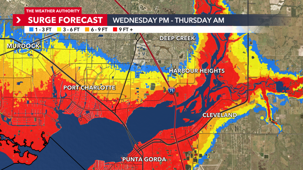
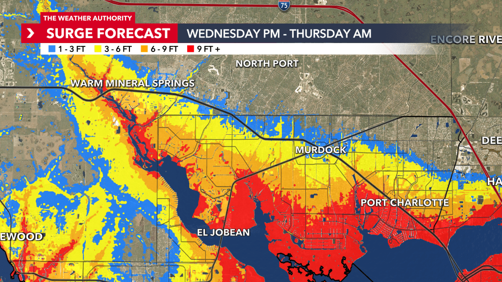
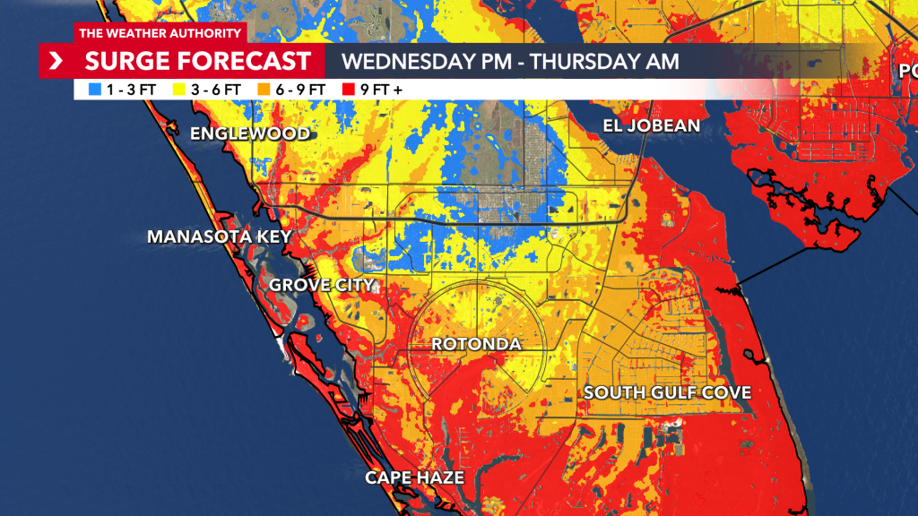
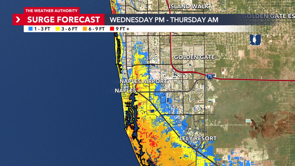
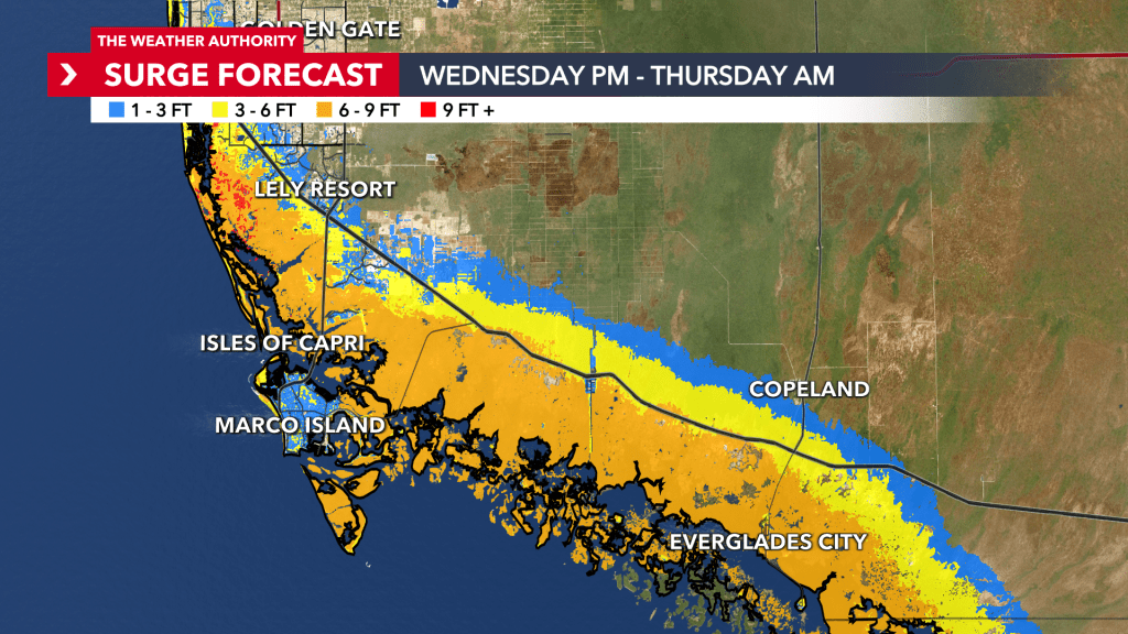
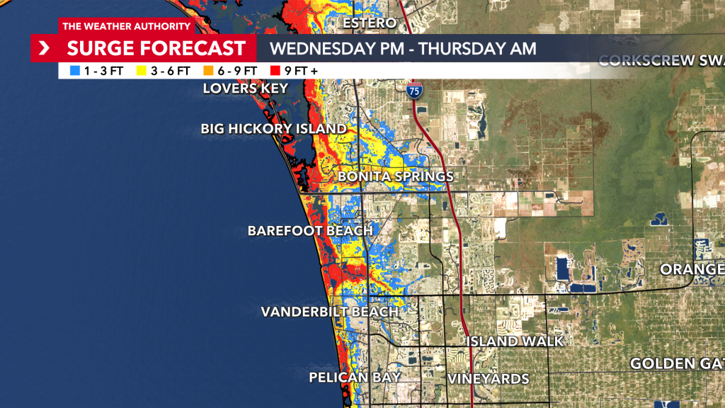
The Weather Authority is tracking Hurricane Milton and the hypothetical worst-case scenario when it comes to storm surge.
Chief meteorologist Matt Devitt discussed the worst-case scenario inundation map, which calculates storm surge and factors in elevation. The results will show the above-ground level during high tide.
Most of the time, levels will not reach the maximum, but it is not impossible.
Check the maps below to see what the worst-case scenario could be in your area.
Click here for the official Potential Storm Surge Flooding Map (Inundation) from NOAA.
Storm surge is defined as an abnormal rise in seawater level caused by a storm, primarily a hurricane, and inundation, on the other hand, refers to the flooding of land areas that are normally dry.
Inundation is the total water level that occurs on normally dry ground as a result of the
storm tide, and is expressed in terms of height of water, in feet, above ground level.
Inundation provides the most clearly and commonly understood method for communicating storm surge-driven coastal flooding. As such, the National Hurricane Center’s (NHC) official forecasts provide storm surge-induced flooding information regarding inundation or feet of water above ground level.
Again, the worst-case scenario isn’t expected to occur, but it’s good to be prepared in the event that it does.
Provided below are links to Lee, Charlotte, and Collier Counties evaluation level websites.
In the search bar feature, type in your street address to view that location’s elevation.